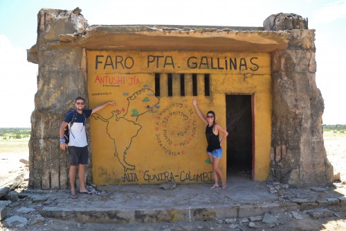
Colombia’s Far North: Cabo de la Vela & Punta Gallinas
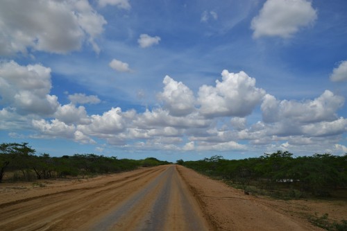
The family visit already brought us high up north, but to reach the northernmost point of South America we had some more kilometers to go. The roads become more desolate & less paved while we were driving further north and it was still a big question mark if we were going to reach our destination (Punta Gallinas).
Did you know?
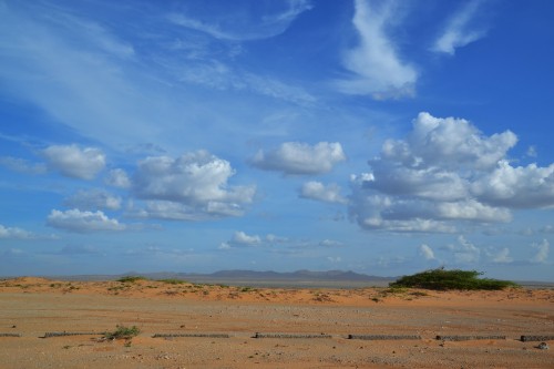
Most people go there on an organised tour, not with own transportation. Not only because they don’t have a car but because there are no real roads (but many “paths”) so navigating on your own is quite difficult. During rainy season the road becomes extremely muddy and even impassable at some points. The area is known for road blocks by locals, where they span a rope over the road to make you stop and ask for money (or a “candy-tax” if you get stopped by children). We heard from other travelers that they got stopped not once, but every 5 meters which made them turn back in the end and not go all the way to Punta Gallinas.
We tried to get more information the closer we were to the area, and in Riohacha (the last real city up north) it seemed already clear we were not going to make it all the way to Punta Gallinas, as even tour agencies currently don’t go there. Not because of the road blocks, but because the road is completely destroyed and impassable due to rainy season & hurricane Matthew that passed by. But we could drive up to Cabo de La Vela and check there again.
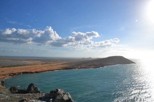
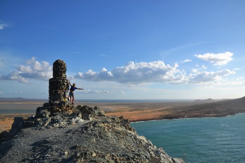
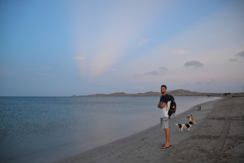
So we did. At Cabo de La Vela we not only already got the “end of the world” feeling, but also a confirmation that going to Punta Gallinas by car was impossible. So we booked a boat+jeep tour that would bring us to Punta Gallinas & drive us around. Not as adventurous as we planned, but it still turned out to be a challenge to get there.
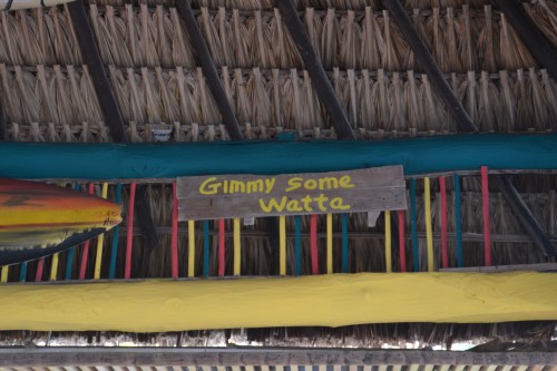
We spend the afternoon exploring Cabo de La Vela, drinking some imported cheap Venezuelan beer & got to bed early. Note: sleeping in a car when the temperature at night doesn’t drop below 25°C and without any wind is not really the best night’s sleep. Not being able to shower the morning after made it even better 🙂 .
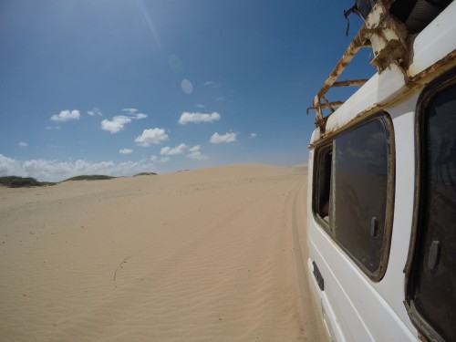
At 4.45AM we woke up and waited for the boat that would pick us up at 5AM. We waited… and waited… 5.45AM… a young kid came: “Ya viene” (He’s coming)… so we waited… and waited… 6.15AM… a woman came: “Ya viene”… so we waited some more… 6.30AM… the woman made some phone calls… while we waited… and waited… until finally a Jeep arrived that said we had to get in fast & that we had half an hour to reach the port… and so we finally left, not in a boat, but in a jeep of which the driver had no problems driving 70km/h on a dusty with potholes infested dirt road while ignoring the sequence of 7 alert signals that went off every 5 minutes. And we thought it was going to be less adventurous than driving ourselves!
But this was only the start. We met the other people of the tour group (that we were looking for the entire morning) and were happy to finally be in a boat. That optimism was quickly washed away when the smooth departure changed into a jumping-on-the-waves-while-the-wind-blows-water-straight-into-your-face boat ride. For 3 hours long it was like we got buckets of sea water splashed all over us. We were soaking wet, couldn’t hold our eyes open & started to feel like refugees in the middle of the ocean (and that’s probably nothing compared to what they have to go through).
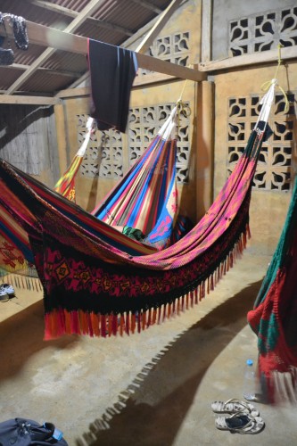
When finally arrived at the “lodge” we saw our sleeping place for the night: a chinchorro, which is a slightly bigger hammock in which we both fit cozy. This was clearly not going to be a maximum-comfort trip 🙂 .
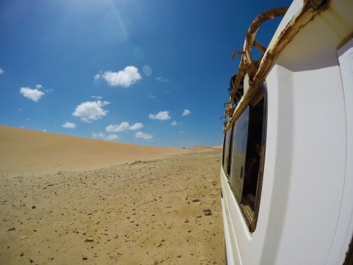
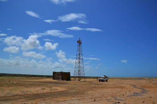
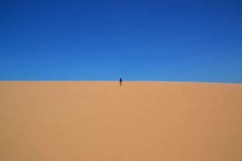
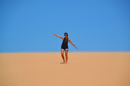
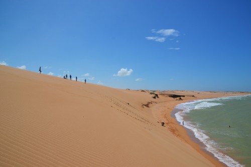
After breakfast we got into the tour jeep, together with 9 other passengers & the driver, also very comfortable in temperatures of over 30°C. We now understand what people meant by that it is not easy to navigate at Punta Gallinas yourselves: there were no roads, only some tracks everywhere; we drove over sand dunes & there was not a living soul around to help you if you would get stuck… so maybe it was for the best that we joined a tour.
Now, was it worth it?! For us it absolutely was, the place has something magical about it. We loved running around in the sand dunes, that end in the ocean, taking pictures, swimming, … And we slept so much better in our hammock than in the car, enjoying a soft breeze all night long 🙂 .
Colombia’s Santander region
Covered in dust we left La Guajira (the region of Punta Gallinas & Cabo de La Vela) & drove 2 days to our next stop: San Gil, Colombia’s adventure capital. Most famous for white water rafting so we had to check it out. After an entire night of heavy rain, the rafting trip was unfortunately cancelled due to high river levels which make it too dangerous to go.
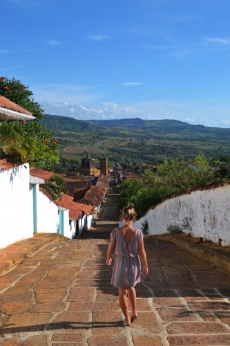
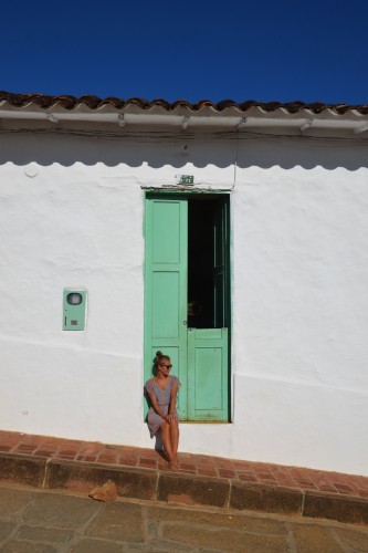
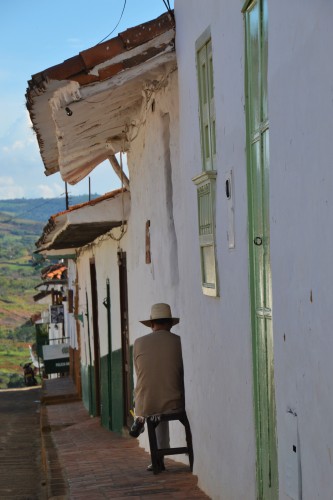
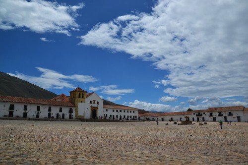
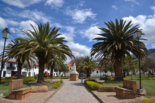
We decided to wait another day & visit a nearby colonial village in the meantime, Barichara. And what a beauty it was! It is one of the best preserved colonial villages of Colombia & it was nice to stroll its streets, looking for photo opportunities.
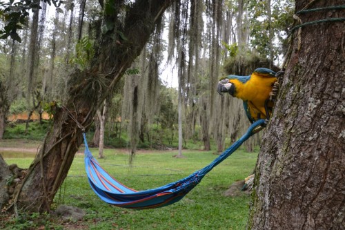
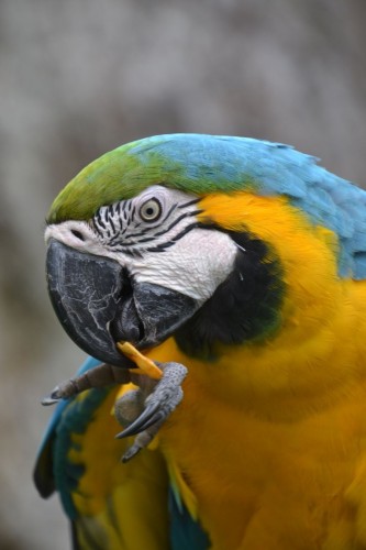
On our camping, we made friends with Laura: the colorful parrot who said “Hola” or “Laura” once in a while, but mainly loved stealing our chips and flipflops.
On the second day we were more lucky and could go rafting, and oh boy, was that fun!
Did you know?
Rio Suarez is for the “daredevils”. It has lots of rapids class 3, but also rapids up to class 4 & 5, which is the highest possible for rafting.
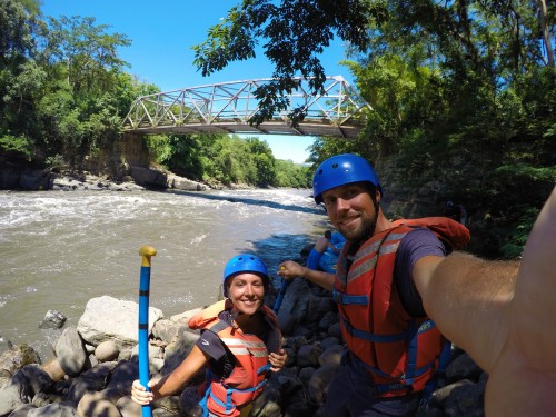
We were rafting in waves up to 4m, following the commands of our instructor, paddling hard or looking for shelter in the boat. We managed to stay in the boat, which seemed for the best, as the water was really going fast & the river was covered with rocks. Hours after we were still euphoric and full of adrenaline!
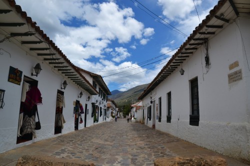
The day after we left San Gil in the direction of Bogota where we had a flight waiting for us in the evening. Plenty of time for a brief visit to another colonial village, Villa de Leyva. Again very beautiful and worth the detour!
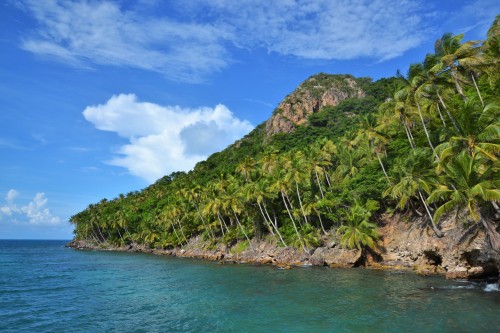
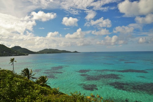
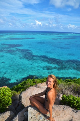
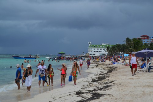
Colombia’s Caribbean islands
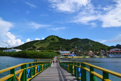
Before making our way south again (back to the land of mountains, volcanoes & high altitude) we wanted to say goodbye to the Caribbean beaches. I had a birthday coming up, so what better place to celebrate this (& fight the 30-ies crisis) than on a Caribbean island: Providencia it was!
Did you know?
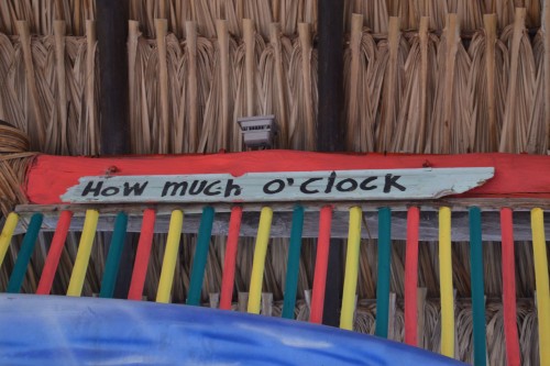
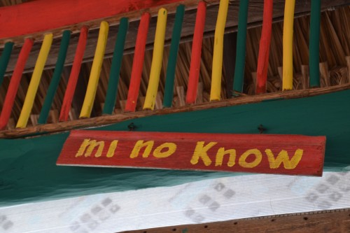
Colombia has 2 islands in the Caribbean: San Andres & Providencia. Geologically they are closer to Nicaragua than to Colombia and they have their own identity. Spanish is the more ‘polite’ language over there, but the language of the indigenous people is Creole. This is a really funny kind of English, but if they are talking to one another, we didn’t understand a word 🙂 .
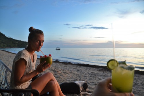
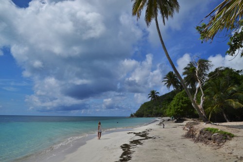
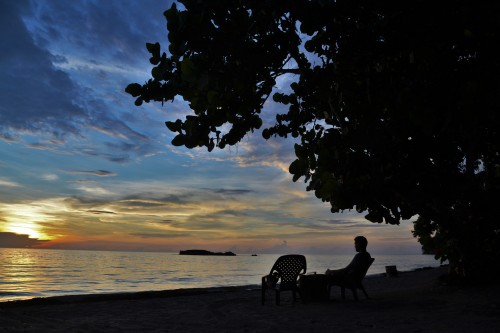
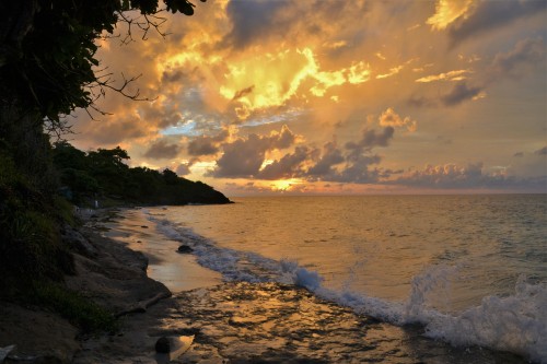
We spend most of our days on Providencia, the smallest of the two islands, where we filled our days with reading, blogging, exploring the island with a scooter, watching sunsets, drinking coco locos, snorkeling, practicing our how-to-get-3-people-and-2-backpacks-on-1-scooter skills, enjoying creole language, … and watching the rain! Yes, we were there in rainy season so we also saw lots & lots of rain (so keep that in mind if the following pictures make you too jealous 🙂 I just don’t like to get my camera wet so no proof of the rain.).
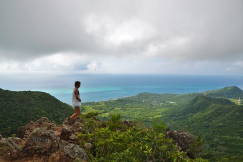
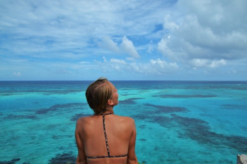
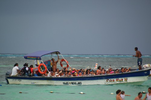
The last day was spent on San Andres island, and where in Providencia it was clear that it was off-season, it seemed like high season on San Andres. Although the sea looked gorgeous, the crowded beaches & boats made us skip the main activities on the island (going snorkeling at another crowded island, or even worse: a ray tour where they hand over a ray from one tourist to another). Thanks, but no thanks.
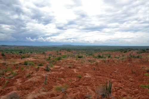
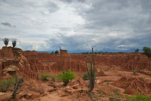
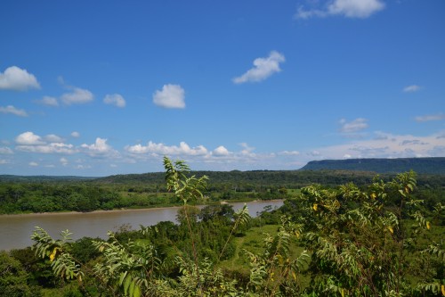
Colombian’s Far West: Tatacoa desert
Although not situated in the west, the scenery of El Desierto de La Tatacoa gives you a Far West feeling.
Did you know?
The Tatacoa Desert is the second largest arid zone in Colombia after the Guajira Peninsula where we were earlier. The area has been gradually drying up to become a desert. The area is heavily eroded and crossed by dry canyons. These shapes are created on clay surfaces, creating labyrinthine gullies in the landscape that can reach 20 meters deep.
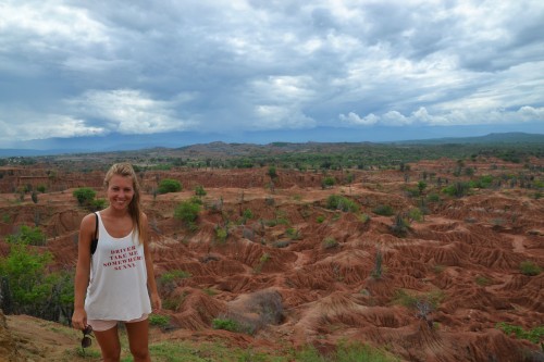
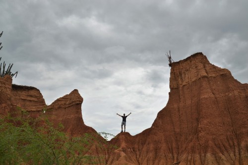
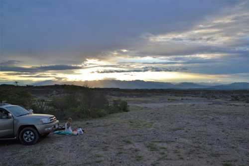
We had fun jumping from clay hill to clay hill, got lost in the labyrinth gullies and were mesmerized by the beauty of this place. We found ourselves a quiet wild camp where we enjoyed a slightly too expensive bottle of wine (An 8$ bottle of wine is a splurge for world travelers! Oh god, we miss the good but cheap wine from Chile, something to look forward to when driving back south!), a good sunset & a quiet night (except for the moment where our car was surrounded by goats on their nightly stroll).
Colombia’s former FARC district: La Macarena
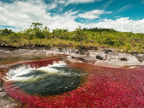
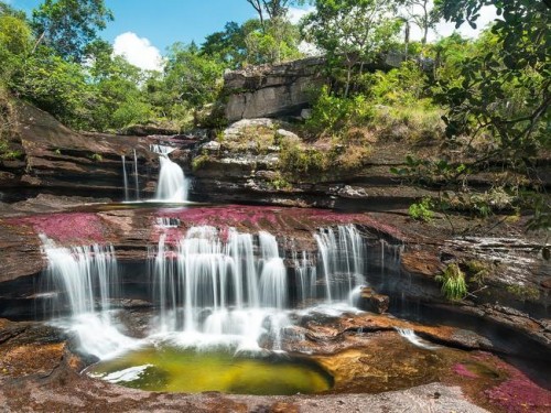
We drove 2 days to reach the village of La Macarena. The tourist draw of La Macarena is Caño Cristales, nicknamed “the river of 5 colors” and even referred to as the most beautiful river in the world due to its striking colors.
Did you know?
The bed of river from July to early December is variously colored yellow, green, blue, black, and especially red, the last caused by the Macarenia clavigera (a plant) on the bottom of the river.
We wanted to check this out because:
- Google pictures looked like this.
- It’s off the regular tourist itinerary & we thought this was going to be an off-the-beaten-track destination that you have to see now before it gets too famous. Formerly the town of La Macarena was only reachable by plane for tourists as it was too risky overland because you’re in the middle of FARC territory.
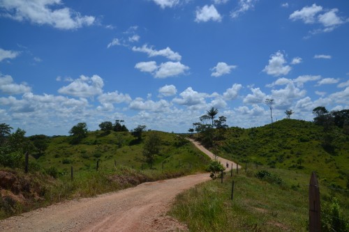
With the current peace negotiations it was perfectly safe for us to travel overland to La Macarena, but it takes time. It is a 2 day drive from the main highway.
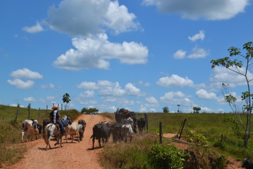
On day 1 the road was mainly paved, with the last stretch being a bit more difficult as it seemed like bombs had exploded under the asphalt. The biggest challenge on this day was getting away from the bar where we stopped for a soft drink 30km before our destination. It was Sunday, packed with locals and – as everywhere in Colombia – after 5 minutes we had to join another table & the first beers were served. 4 (light) beers later we learned that our “new friends” were a couple with quite some age difference, him being 41 years old while she was 14. The guy seemed very proud & the girl very in love, but I saw Benjamin’s face turning a bit more disgusted. We figured out already that she was way younger than him, but did not expect that she was still in high school.
Apparently, that’s way more adult in Colombia than in Europe, as she was old enough to drive his motorcycle home, with him being insanely drunk sleeping sitting behind. We followed them the whole way, and luckily they made it safely home. We kindly refused the offer to sleep at his house & looked for a hotel ourselves in San Vicente de Caguan. We got a little help from the local police, who – as every Colombian – were so friendly to escort us to a hotel, with flashing lights all across town!
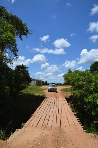
On day 2 we said goodbye to paved roads & the biggest challenges became ditching potholes, car balancing on wooden bridges, crossing some rivers and finding the correct road.
We reached La Macarena and found out that we couldn’t visit Caño Cristales the next day as the office where we needed to get our permit was closed. We also found out that all the prices & tips to keep it budget friendly we saw on the internet were outdated and that everything recently got regulated. Doing it on the cheap seemed not really possible anymore. But we came this far, so decided to wait another day to get more information from the office.
In the meantime, we watched the village life & did an overpriced kayaking tour. We were starting to get a bit annoyed that you cannot easily do something on your own over there & need a guide for everything. Luckily the tour brought us to a nice stop: a finca where they do a breeding program for river turtles and where we made 2 new monkey friends.
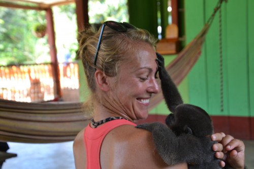
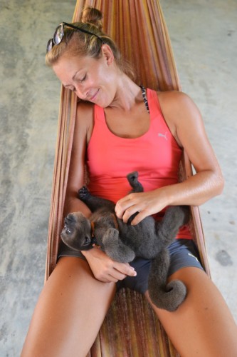
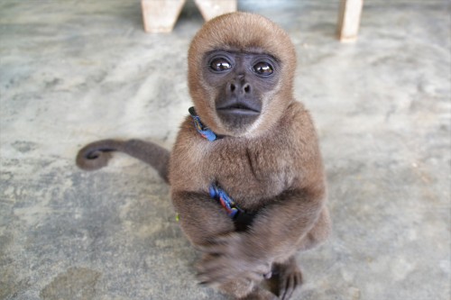
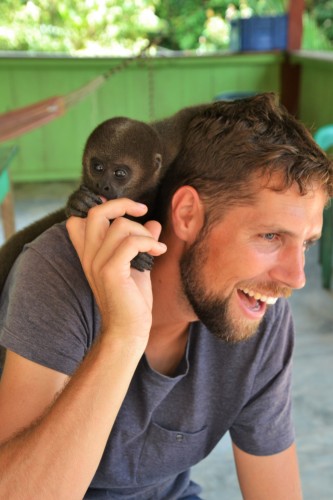
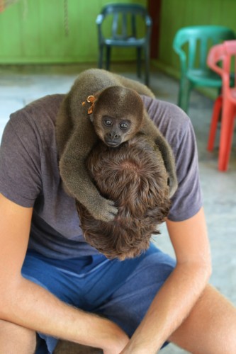
Those 2 monkeys are orphans as the mother was killed in order to take the babies & sell them as a pet. The police took them away from the people that paid for this & the owners of the finca are now taking care of them. Sad that these little fellows cannot grow up on the back of their mother. Although they were fun to watch & extremely cute, it left us also with a sad feeling how cruel & stupid people can be.
The next day we went to the permit office where the lady told us that Caño Cristales is currently dry, you cannot really see the red color & cannot swim in it. Normally the season runs till the end of November, but they hadn’t had rain for weeks. Luckily the lady was honest, and we could save our money.
We left the town, ready for another 2 days of driving back the same road, with mixed feelings. It’s clearly one of this places that has discovered that it is special and started to ask ridiculous prices (it would have costed us 60$ to 100$ per person, depending on group size). We cannot confirm if the sight of Caño Cristales is worth it, but it is definitely not a budget traveler off-the-beaten-track destination like we thought it would be.
This was our last stop in Colombia and we left with the same weather we arrived with: pouring rain all day long… seems like we’re approaching Ecuador 🙂 .
The video wrap up: