If you are up to hike the Everest Three Passes trek yourself, here you find our detailed day-to-day itinerary. We describe the stages, the altitudes and the hiking times.
If you are rather interested in our highlights, our personal records and the things we will not miss from the trek, read it here.
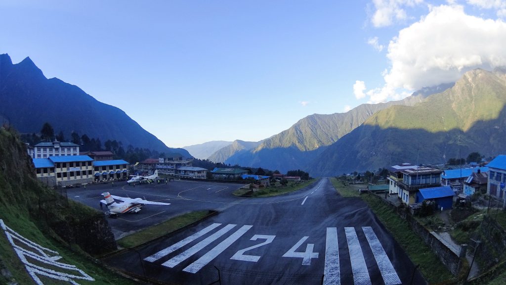
Day 1: Lukla (2800m) – Phakding (2600m): 2,5h hike
- Nice easy warming up hike from the Lukla Airport to Phakding. Elevation is slightly lower which is good for acclimatising since you flew immediately in to Lukla. Some people walk 6 days from Jiri to Lukla and have already a gradually ascent which makes this stop unnecessary.
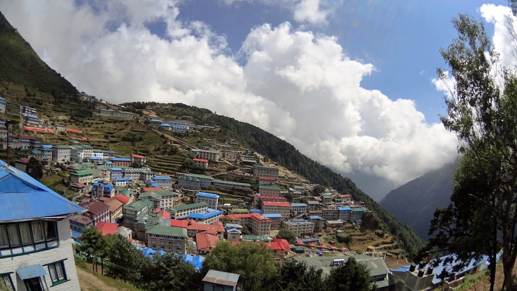
Day 2: Phakding (2600m) – Namche Bazar (3420m): 4,5h hike
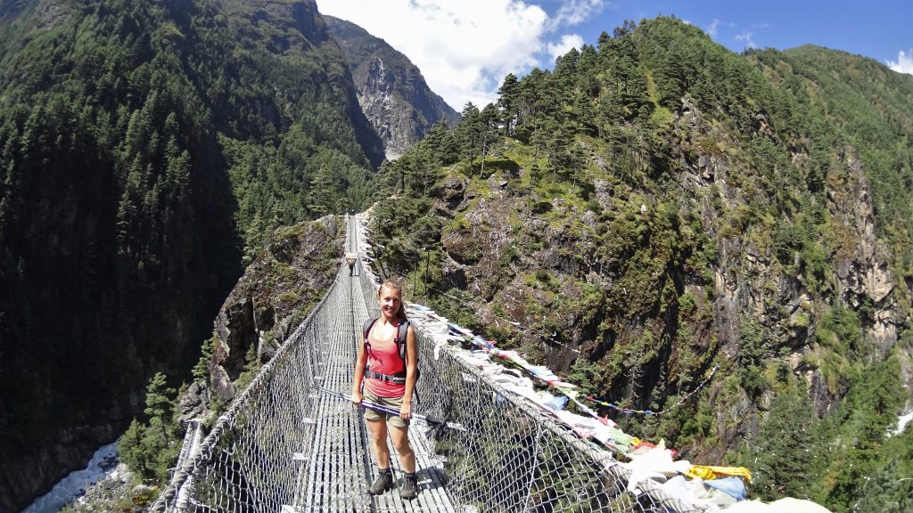
- No time to waste and immediately a hard day in ascending. First part is fairly flat along the Dudh Kosi (Milk River) until you reach the foot of the hill where Namche Bazar lies on top. Cross the river and then a 2,5h ascent.
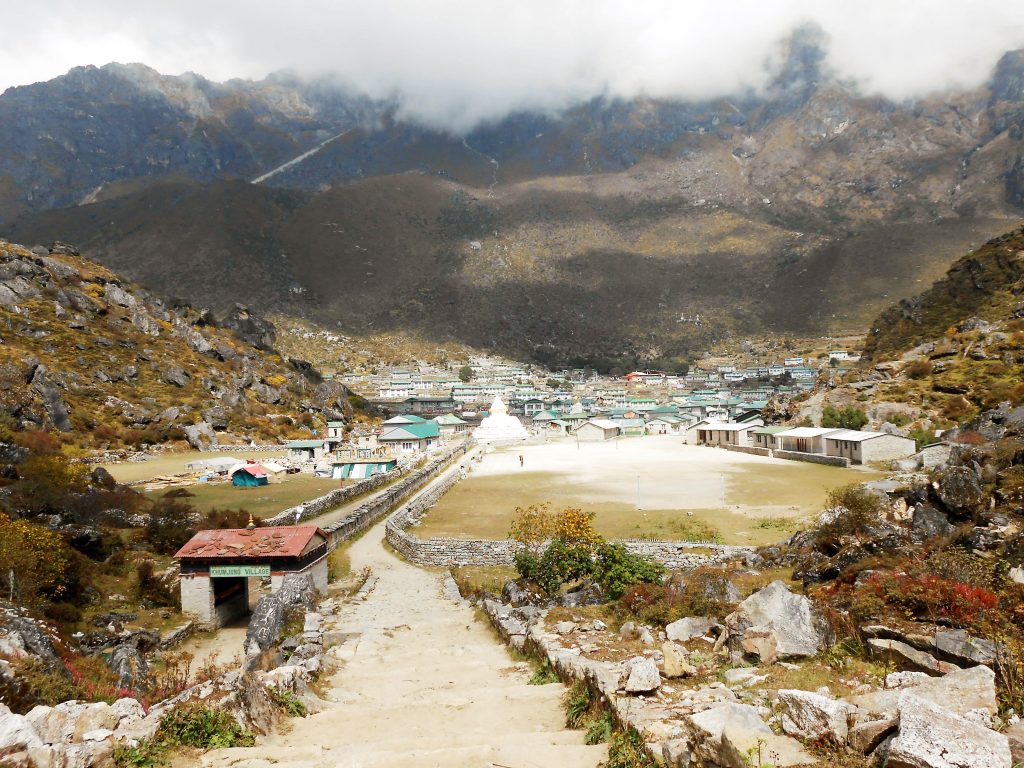
Day 3: Rest day in Namche Bazar: Walk to Khumjung (3780m) and back: 4h hike
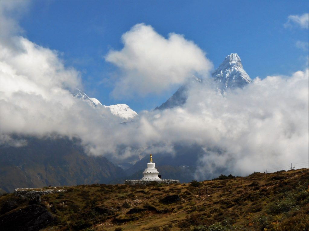
- Resting days don’t mean resting, but acclimatising! We walked up to Khumjung (a Sherpa village) and had already the first nice views on the mountains: Thamserku, Ama Dablam (means: beautiful mother), Lhotse, and many more.
Day 4: Namche Bazar (3420m) – Thame (3750m): 4h hike
- This was an easy walk through the authentic valley, passing many small farm villages to Thame. Note: The Thame village was 95% destroyed during the earthquake, but was at the moment fairly rebuilt leaving only a few families in tents of Red Cross Germany.
- In the morning, the views on the snow-capped mountains were amazing.
Day 5: Thame (3750m) – Lungden (4350m): 3,5h hike
- Proceeding higher and higher, we walked up until Lungden, which is the last village before the Renjo La Pass. On this day we broke our personal height record of 4035m (Weismiess in Switzerland)!
- Very nice, remote farm valley with many Yaks. During our walk we only passed 1 tourist and 5 locals.
Day 6: Rest day in Lungden: hike to nearby hill: 2,5h hike
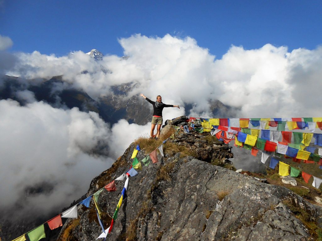
- On this day we hiked up a hill next to the town and crossed 5000m for the first time. On top of that hill we had a nice view on the entire valley and the mountain range behind it which forms the border with Tibet.
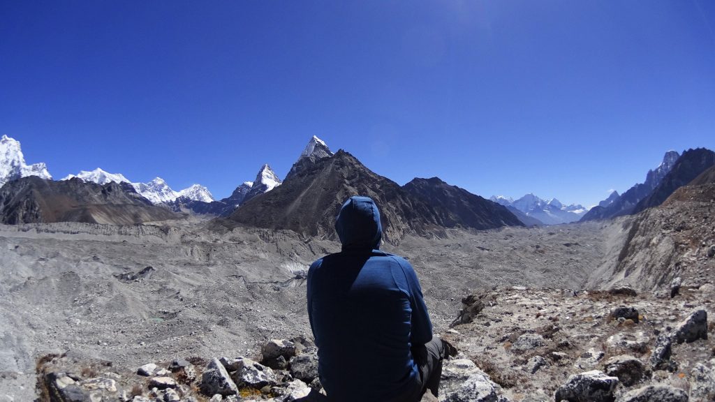
Day 7: Lungden (4350m) – Renjo La Pass (5350m) – Gokyo (4800m): 7,5h hike
- The first big challenge ahead: our first pass. We got up at 4h15 in a room of 4°C, had a mushroom soup and started around 5AM with walking. We walked for many hours into the shade so the temperature was -5°C at times. As you can imagine, our hands and toes were freezing and we were longing for the sun. After hiking up for about 5 hours and ascending approximately a 1000m, we reached the Renjo La at 5350m. They say the most beautiful views in the Everest mountains are seen from the Renjo La and we couldn’t agree more! Just WAAUW! It’s funny that once you reach the top, you immediately forget the effort you have just done for hours and hours. After 1 hour we started (Céline started to feel dizzy, because we stayed too long at the top) descending to Gokyo. You can see the village from the top, but it takes a difficult walk down of 2,5h. A lesson we learned is that distances are not what they seem. You always underestimate the time it takes to get there.
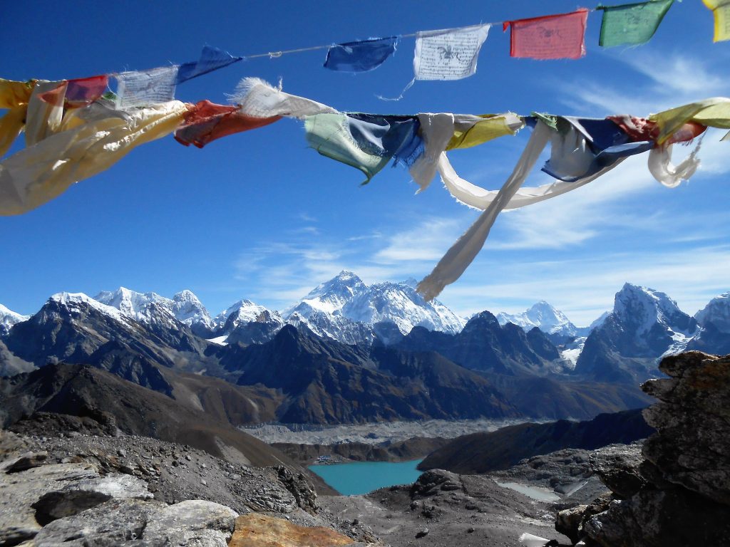
Day 8: Acclimatisation day in Gokyo: Hike to the fourth and fifth lake (4950m): 5h hike
- Again a ‘resting’ (aka acclimatising day since Gokyo is almost at 5000m) and we could sure use it after the Renjo La Pass day. At Gokyo there are several options for a day hike: walk up the Gokyo Ri (a hill next to the village) or a walk up to the fourth or/and fifth lake. We chose the latter, since the views at Gokyo Ri are the same than from Renjo La, but just closer and thus less of an overview. Up to the lakes we went. The Fourth lake was reached quite fast, so we decided to go further up to the Fifth lake which made it a long day after all 🙂 .
- But, from there we had a great view on the Ngozumpa Glacier and its surrounding mountains (Cho Oyu, Everest, Nuptse, Lhotse, …).
Day 9: Gokyo (4800m) – Tagnag (4700m): 3h hike
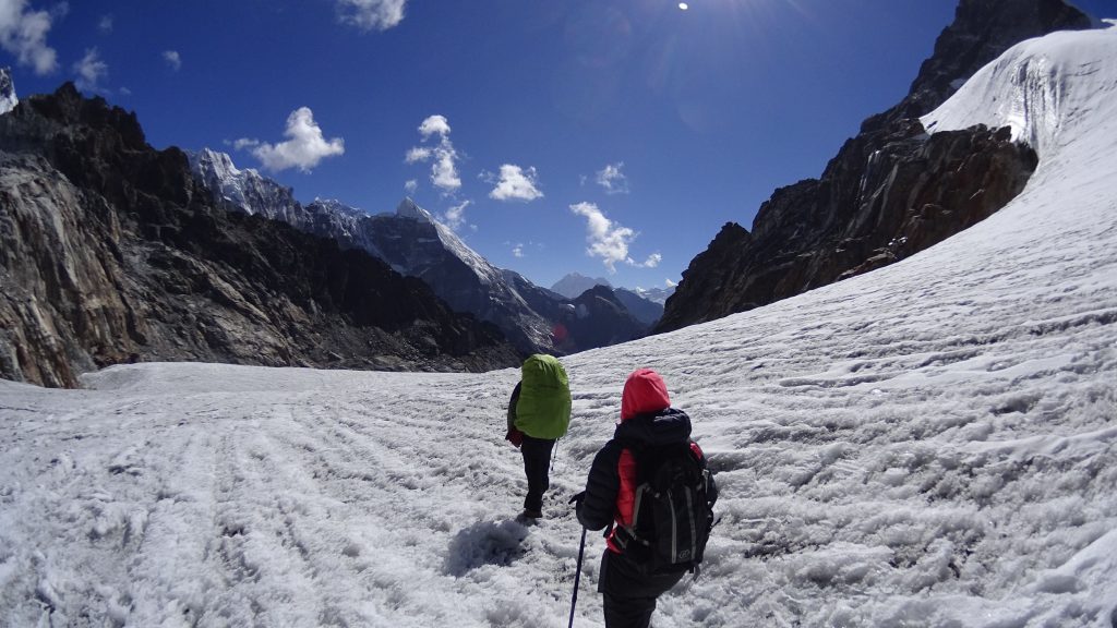
- A short hike towards Tagnag crossing the Ngozumpa Glacier. The reason is that it takes too long from Gokyo to immediately cross the Cho La Pass in 1 day.
Day 10: Tagnag (4700m) – Cho La Pass (5350m) – Dzonglha (4830m) – Lobuche (4930m): 8h hike
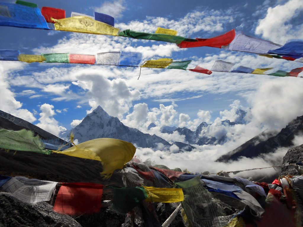
- The second difficult day: the Cho La Pass. They say it’s harder, but the pass itself takes a bit shorter. Again we started very early at 5h30 so we wouldn’t come across too many people on the pass itself. The reason became very obvious when we arrived at the steep ascent on the mountain hill. One side of the pass is scattered with rocks and sand. This in the combination that it is very steep, makes it quite dangerous for slipping and sliding rocks. The ascent takes about 3 to 4 hours. And again … crossing the top, we were treated with an amazing view, this time of the glacier we had to cross lying between several mountain tops. And if that was not enough, after the glacier and passing a mountainside on the right, we were treated with a second amazing view into the enormous valley with a lake and the majestic Ama Dablam at the end. Again WAAUW!
- We didn’t take rest in Dzonglha and went on to the next village Lobuche because this way the following days and sleeping nights would fit our schedule better. This extra trip made it our longest day of hiking in this area.
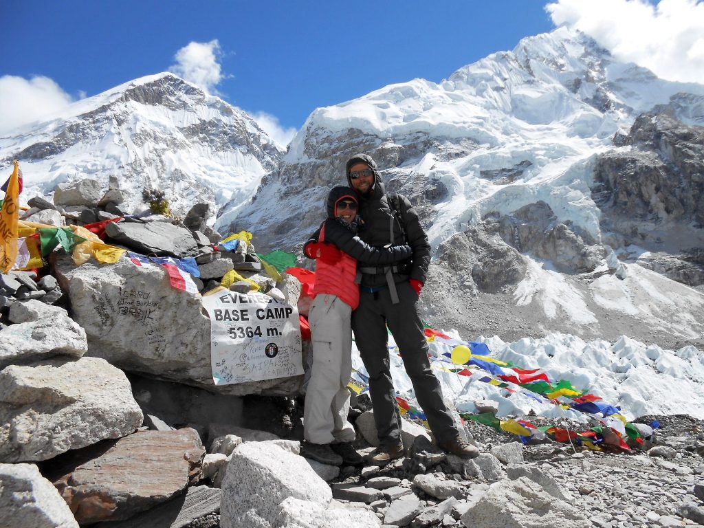
Day 11: Lobuche (4930m) – Gorak Shep (5180m) – Everest Base Camp (5350m): 7h hike
- Lobuche is on the regular Everest Base Camp (EBC) trekking and we immediately noticed that this trekking was much more crowded than the 3 passes that we did. We arrived in a completely full lodge packed with large groups who all seemed to know each other because they travelled together for the past 6 or 7 days.
- Because we didn’t want to be packed in line during our walk, we again got up fairly early and took off to the highest village of the trekking: Gorak Shep (5180m), where we would spend 1 night. Once we arrived there after a rough path with many rocks, we threw off our bags at the lodge, had a soup and went straight to Everest Base Camp.
- Everest Base Camp is not the place you MUST see. At the time we were there, there was not a single tent because there were no current expeditions. So it is just a stone with flags at the start of the Khumbu Icefall on the glacier and a sign telling you that you are here. But you can’t do a trekking in the Everest region and not go to Everest Base Camp + it makes a nice Facebook picture 🙂 .
Did you know?
This year no climber will have succeeded to reach the Everest top as the Japanese Kuriki recently abandoned his attempt 700 meters below the top. Due to the earthquake and no successful expeditions none will have made it to the top this year. This has not happened since 1974.
Did you know?
An Everest climb takes about 2 months to successfully complete and costs up to 50.000 Euro in total.
Day 12: Gorak Shep (5180m) – Kala Pattar (5550m) – Pangboche (3870m): 7h hike
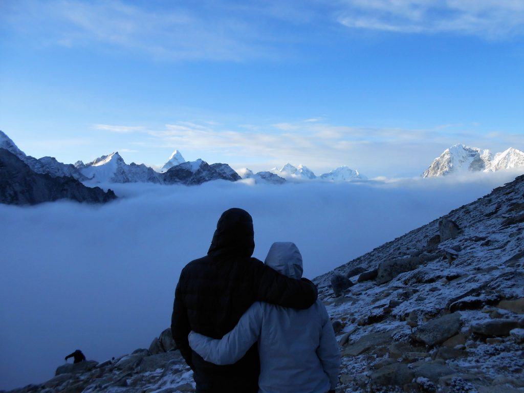
- We got up (again!) very early at 4h45 to climb Kala Pattar (5550m) because this hill offers you great views of the Everest. Note that we already saw the Everest quite some times, but this would give a close look of the big black mountain. It was very foggy and even snowing a bit, so we wondered whether we would go up or not. We decided to go for it and hope for the best. Halfway on the hill we were above the clouds and had again a nice overview of the mountains and the Everest in particular.
- Note: you can’t see the Everest from its Base Camp. So people doing the EBC trekking have to wait until the very end to have a good glimpse of the world’s highest mountain.
- After this early morning rise (out of bed and on Kala Pattar), we decided not to do the 3rd pass (Kongma La) and head down. We had seen many beautiful views, were enough over 5000m and had experienced enough of the cold and early mornings J. So we went down. And far down. We met the clouds that we transcended on Kala Pattar on our way down. About half of the day we walked in the fog towards Pangboche.
Day 13: Pangboche (3870m) – Benkar (2710m): 7h hike
Day 14: Benkar (2710m) – Lukla (2800m): 3h hike
- The last two days we went down on the regular Everest Base Camp trek path, but don’t let this fool you that you don’t have to go up anymore. Mountains stay mountains and we had to hike up and down for many hours. As we went lower and lower, the temperature started to increase and we could even take off our jackets for the first time in 8 days.
Day 15: First flight out of Lukla.
- We got the first flight! So again, that meant getting up early :-).
- We had of course mixed feelings with the end of this trip: we had suffered a lot, but also have seen things that you can’t see without all this effort (unless you have a lot of money and take a helicopter). So, would we do it again: OFF COURSE. Would we recommend it? OFF COURSE!
Our tips for the trekking:
- Do the Three Passes trek or an alternative instead of the regular EBC. This is much less crowded and the views that you get on the high passes are priceless!
- If you do the 3 passes: go from east to west. This is harder for acclimatising, but we believe you are more rewarded with the views this way. You walk up, sweating and puffing and each time you cross the edge are rewarded with the fabulous view. The other way around you would otherwise see this view growing each time when you look over your shoulder which makes it less spectacular.
- Babywipes were doing the trick for us instead of a cold shower. Don’t forget to bring this.
- We had all kinds of medicines with us, but nothing against a simple cold. I think half of the trekkers get a cold during the trip.
- Diamox is a medicine against altitude sickness, but also can work preventive. In a small dose it helps you to acclimatise faster. So it doesn’t eliminate the symptoms but makes your body do the stuff that it would normally do when acclimatising. So if you feel better with Diamox, you are actually better. We took it on our ascending days up to 5000m and then stopped.
- Take a porter(guide). It is first of all an income for them + it makes your trip much easier and you have more time for looking around and taking pictures.
- Walk early in the morning, since the mountains have the nasty habit of being clear in the morning and letting in the clouds in the afternoon. That’s also the reason why you should try to have the first flight to and from Lukla. The weather is better and less chance of cancelled flights.